
From the Travely-Family archive · Patagonia and Tierra del Fuego
Cape Horn to the Cape of Good Hope
An original publication from the former Travely-Family website. This English translation was preserved from the technical-site archive without editorial rewriting.
Cape Horn to the Cape of Good Hope. Details of Stage 2 of the First Russian Round-the-World Expedition with Children via the three Great Capes: the Chilean fjords, the Strait of Magellan, the Falklands and Tristan da Cunha.
Ready, set, go!
We had planned to set out towards the Cape of Good Hope on 10 July. But a few days beforehand, the cold snap arrived. What is –10°C to a Siberian?...But this is not Siberia; it is positively sub-Antarctic. Where summer is not really summer, and winter is not really winter. And –10°C turns into something close to a natural disaster: the pipes have frozen, there is no water in our neck of the woods, and there has been none on the landing stage for ages, which means no shower and no toilet. And fewer and fewer people are brave enough to light the stove there.
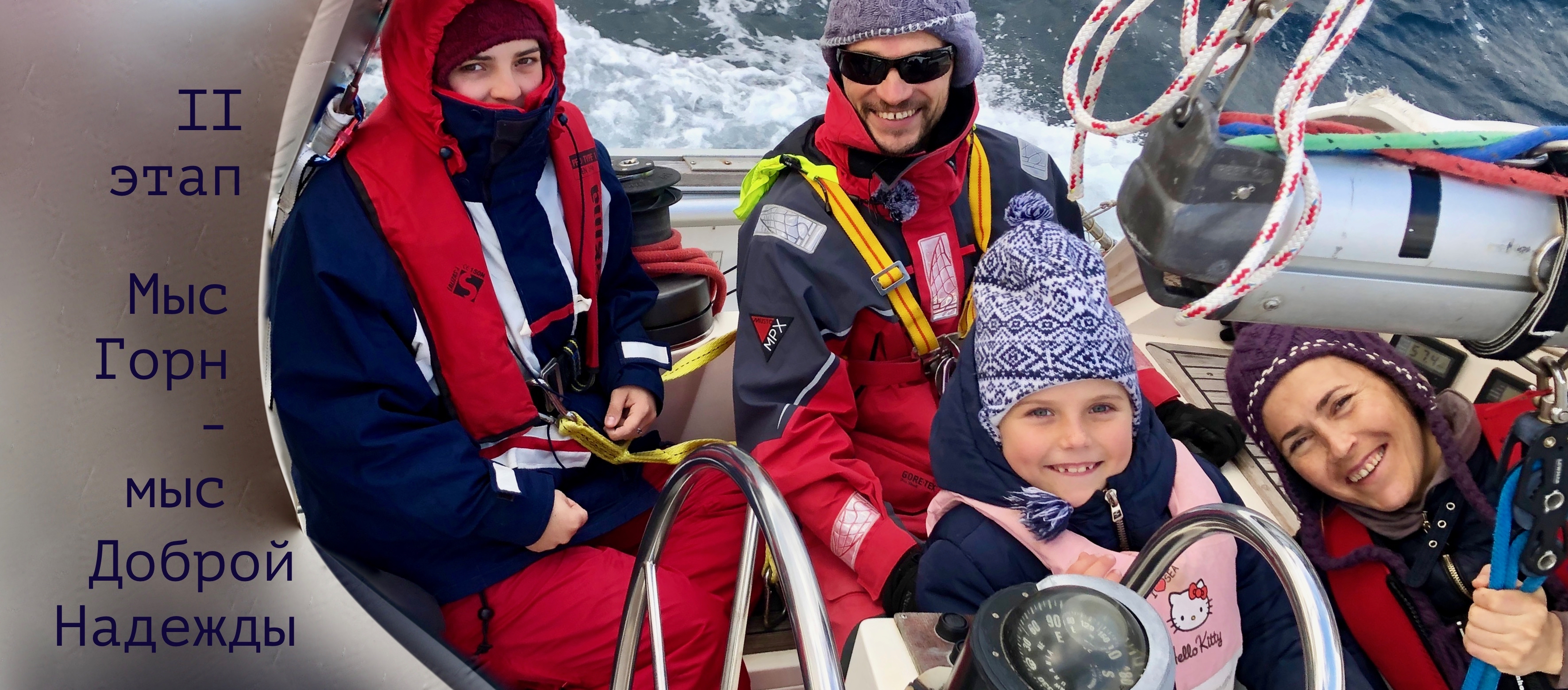
But the saddest thing is that Cedena, the children’s sailing school, is not operating either—there is no water, after all. Curiously, they have a winter like this every year, yet the water pipes are above ground. Do they forget during their green winter that in the white winter everything bursts and stops working?
But that is not why we are not setting out into the Patagonian fjords. In this cold, even with two electric heaters running constantly, we start the diesel twice a day for warmth. Otherwise it is far from balmy. And if we put to sea at –10°C, without shore power for heating we will not have enough fuel for the planned three weeks before refuelling. It stormed until 17 July; then we waited for the gas to be delivered. We are setting out at dawn on 18 July. Oh... 18 July is an anniversary for the captain and me: twenty years since we met. Well, that came back to me rather suddenly:).
Money matters
By the way, if we previously called dear Micalvi the yacht club of victorious communism, where there was nobody to collect any fees, this winter the Chilean Navy has put an end to that chaos. As a result, for a month and a half at the berth we paid—with a discount for the captain’s charm—540,000 pesos (about 54,000 roubles). The price includes the berth, water, electricity and internet.
Down to business
We will refuel and stock up on fresh food in Punta Arenas, a city on the shore of the Strait of Magellan. They say it is extremely uncomfortable to stay there because the place is exposed, and the Strait of Magellan acts like a pipe—the wind whistles through it from the Pacific to the Atlantic as if it owns the place. But can we really take their word for it? We shall have to check for ourselves:).
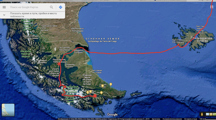
The Strait of Magellan—Falkland Islands. Red circle: Puerto Williams; red star: Punta Arenas So, first we will reach the beam of Ushuaia.
We are not allowed to enter Argentina, so we will anchor opposite it. There is a wonderful bay on the Chilean side. I was already rubbing my dry little hands together at the thought that we might still catch the remnants of Ushuaia’s internet. Perhaps it would reach us from the Argentine shore? But the captain said nope, our package has expired. So it looks as though this internet really is our last for the next three weeks or more.
1. Puerto Williams—Punta Arenas
We will head west along the Beagle Channel to the Pacific side and into the southern Patagonian fjords.
The Chilean coast is so deeply indented that you could spend six months there without once spending the night at the same anchorage. In summer, travelling through the fjords from south to north is not very convenient, because Pacific cyclones slam into the Andes and unleash their full force directly into yachts’ faces. But in winter, contrary to popular belief, the headwinds weaken, and as the sailing directions say, cruising in these waters will impress you so much that you will agree to become a local beaver if only you never have to leave. So we are going through the fjords in the right season:). Incidentally, not all narrows, channels and bays may be entered.
The Chilean Navy will not let you in, and it is best not to quarrel with them.
After eight to ten anchorages—depending on how much ice there is in the bays—we will enter the Strait of Magellan from the west and drop anchor off Punta Arenas, a city on the northern shore of the strait. Here we will refuel and cram the forward cabin with vegetables and fruit (we plan to eat the previous cabinful, bought by the crate in Puerto Williams, while we are in the fjords). The girls usually live in the forward cabin, but six months ago we turned it into a cold storeroom, because the heater cannot understand what kind of all-hands emergency we have staged for it and refuses to heat the entire floating home evenly. Otherwise it begins to stink of diesel exhaust. So we try not to anger it unnecessarily. 🙂
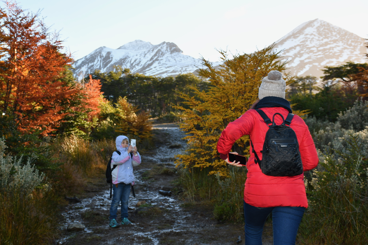
And the photo is not about diesel; it is about the beauty of Tierra del Fuego.
Children in Patagonia
2. Strait of Magellan—Falkland Islands
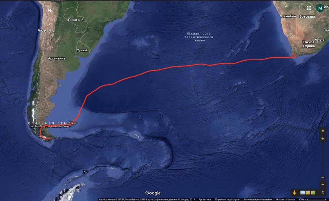
We plan to spend several days in glorious Punta Arenas, then set out through the chilly Strait of Magellan into the South Atlantic. The Falkland (Malvinas) Islands are 800 nautical miles from Puerto Williams, but only half that distance from Punta Arenas. Across an exposed shelf open to wind and waves, however, with savage seasickness by the look of it. We hope there will at least be no icebergs.
If Her Majesty’s British subjects in the Falklands let us in without a visa, we would like to roam the channels in search of fur seals and sundry penguins that, through some misunderstanding, have not gone to spend the winter at sea. There may be internet there, but that is not certain:). And most likely, we will choose penguins over social media. After a couple of weeks in the Falklands, the main forced march of Stage 2 of the expedition via the three Great Capes will begin: the passage to Tristan da Cunha and onwards to the Cape of Good Hope.
3. Falkland Islands—Tristan da Cunha
We will plot the route once we are in the Falklands, depending on the winds and the ice zone. We will probably head north at first.
There is also Plan B—we do not know why, but it exists—Uruguay and its capital, Montevideo. It is warm there, and opposite, across the wide river mouth, which also happens to be an ocean bay, lies Buenos Aires, which we are not allowed to enter anyway (we have used up all our visa-free days).
Under Plan A, on the way to the Cape of Good Hope there is only one almost impossible place to stop in the ocean, on the only inhabited island for thousands of miles. For simplicity’s sake, it is called Tristan da Cunha, like the entire island group. And as many as 270 people live there, through thick and thin. According to unconfirmed reports, the Tristan da Cunhans have Nordic characters and knock back whisky (out of loneliness, apparently) more furiously than the whole British Empire put together.
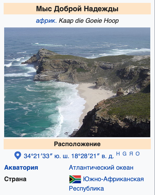
This is another British Overseas Territory, along with the Falklands and Pitcairn.
Old Mother England does love possessions at the very edge of the map. Tristan da Cunha competes with Easter Island for the title of the most remote inhabited island on the planet.
But the whisky and underpopulation are not Tristan da Cunha’s greatest sorrow. What concerns us most is the fact that anchoring there is extremely difficult. All the anchorages are exposed, and the weather is none too pleasant, especially in winter. A stop of several days at Tristan would be a wonderful gift during the long 5,200-mile passage. Otherwise, we will be stuck on a nonstop crossing of the South Atlantic all the way to the Cape of Good Hope, for almost two months..
4. Tristan da Cunha—Cape Town: 1,500 nautical miles (2,800 km)
Thirty miles from Cape Town lies that very Cape of Good Hope, celebrated by poets and writers.
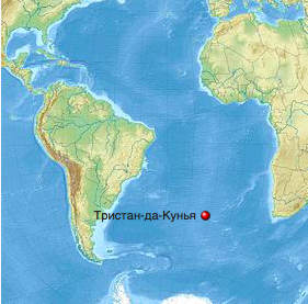
While Lady Mary makes her way through the Chilean fjords and crosses the South Atlantic Ocean, spring will begin at the Cape of Good Hope, increasing our chances of avoiding a storm on the approach to the African continent.
We are beginning to keep our fingers crossed that it all comes together there as well.
Sailing the Southern Ocean in winter is not recommended. But the captain has been monitoring the weather for Stage 2 for almost six months now and sees no great difference between the summer and winter cyclones en route to the Cape of Good Hope. The only difference is the cold. We are used to that by now.
In Cape Town we plan to repair the yacht and set out immediately after New Year on the next difficult stage—across the southern Indian Ocean through the Roaring Forties (just the way we like it) to Australia.
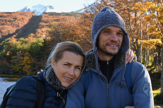
The captain and me in Patagonia, back when it was still autumn there 🙂.
Summary
It looks as though this is the last report with pictures this season. From now on, follow our satellite chronicles. We will send them regularly. Hugs to you all, and good luck on your own Journeys! Thank you for your support, your warm words, your concern and your sense of comradeship.
A huge thank-you to everyone who keeps our fighting spirit fuelled by contributing to the expedition budget through Paypal.me/TravelyFamily and Yandex.Money.
Our thanks to Leonid K. from Singapore, Ivan B. from Vladimir and Anna Z. from Surgut. We can feel that you are with us! Your donations mean that we are doing something useful and worthwhile—helping dreamers spread the wings of their great dreams and believe in themselves.
May it all come true! We move forward together.
Friends, write to us!
Thanks to the helping hand of our friend Mikhail Tarasov (Misha, thank you!) and JSC MVS Telecom
(Iridium), we are always connected, wherever we are. You can follow us via this satellite tracker:
Iridium360.